Iroa: Difference between revisions
Phoenia652 (talk | contribs) No edit summary |
Phoenia652 (talk | contribs) No edit summary |
||
| Line 16: | Line 16: | ||
|leader_title = First Minister |
|leader_title = First Minister |
||
|leader = Soleiman Kobani |
|leader = Soleiman Kobani |
||
| − | |ethnicity = Granas 48.8% </br> Basra 29% </br> Iro Wuster 5.1% </br> Vagani 5% </br> Basargu 4.5% </br> Carsodon 3. |
+ | |ethnicity = Granas 48.8% </br> Basra 29% </br> Iro Wuster 5.1% </br> Vagani 5% </br> Basargu 4.5% </br> Carsodon 3.7% </br> Tekkian 3.4% </br> Parast 0.6% </br> Wuster 0.1% </br> Saguro 0.1% |
|population = 5,264,395 |
|population = 5,264,395 |
||
|area = 36,527 |
|area = 36,527 |
||
Revision as of 17:41, 2 January 2025
|
Iroan Republic
جمهوری ایروا
Jamehori Ayroa |
|||||
|---|---|---|---|---|---|
 |
|||||
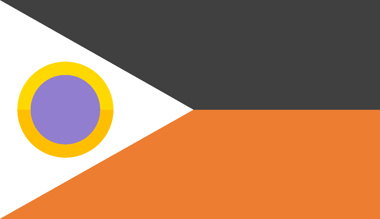
| The flag of Iroa, featuring its national symbol. | |||||
| Motto | "Ba npam bah jelo: Dar azadi" "Forward together; Free" |
||||
| Common Name | Iroa | ||||
| Anthem | "Vatanam" | ||||
 |
|||||
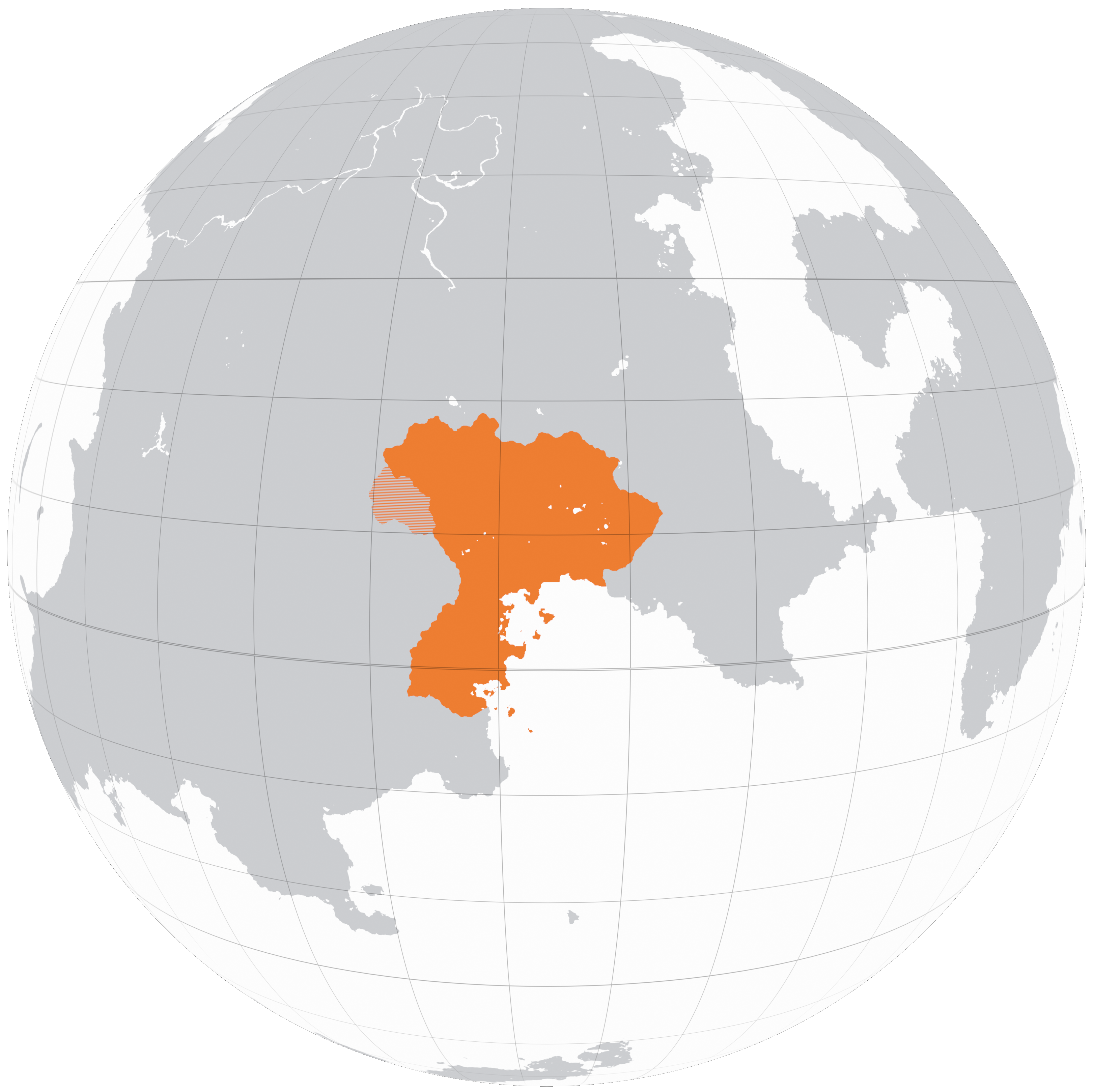
| A map of Iroa in Kolus, 2200 | |||||
| Demonym | Iroan | ||||
| Official languages | Granas, Basra | ||||
| Currency | Rút | ||||
| Politics | |||||
| Capital | Maslouf | ||||
| Government | Devolved unitary parliamentary republic | ||||
| Foundation | 2122 (Declaration of Independence) 2127 (Formal Recognition) |
||||
| First Minister | Soleiman Kobani | ||||
| Preceded by | Granderia, Arcovdonia, Phoenia | ||||
| Demography | |||||
| Ethnicities | Granas 48.8% Basra 29% Iro Wuster 5.1% Vagani 5% Basargu 4.5% Carsodon 3.7% Tekkian 3.4% Parast 0.6% Wuster 0.1% Saguro 0.1% |
||||
| Population | 5,264,395 | ||||
| Area | 36,527 km² | ||||
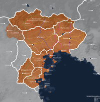
Iroa, officially the Iroan Republic and sometimes informally Iridia, is a country located in southeastern Kolus, founded in 2127 following a democratic revolution in 2122. As of 2200, following the annexation of the remnants of Carsodonia, the Republic consists of 10 provinces (velayat) further divided into governorates (estandari) and sometimes special districts (shahrestan). Notable cities include the capital: Maslouf, Iroa city, Mede, Marea and Taezh. Iroa has a population of 5,264,395.
Iroa is a representative democracy within a devolved unitary system. It is best characterized as a middle power, lacking the ability to far reaching or wider regional military and economic power, but is still substantially involved in its immediate vicinity through diplomacy, trade and the occasional small conflict. It is a member of the Federation of Greater Aontas, a multinational union.
Etymology
The mythology of early Koloan and Proto-Iridian tribes who inhabited the plains of central Kolus held supernatural explanations for climate phenomena. The Qara mountain range which bounds the Gaineamh tropical desert, the only one of its kind on Kerbin and hostile to their way of life represented region cursed by spirits, or "Al-arwah," which eventually through language drift came to describe the region itself.
| “ | "...and so it was the hero Malik and his noble band would enter. Awaiting them, 40 days and 40 nights of trial in the land of Alarwah" | ” |
| —, Ancient Koloan tablet | ||
The correct usage of the term "Iridia" is disputed by kerbologists, and refers broadly to the region where the Iridian people live. However it is sometimes colloquially used interchangeably to refer to the the nation of Iroa.
Geography
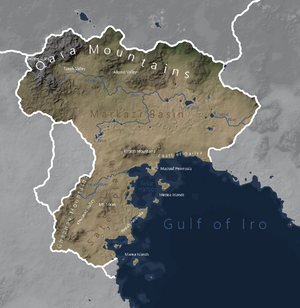
Iroa is located in southeastern Kolus as part of the Kulge subcontinent. It covers an area of 36,527 square kilometers between longitudes -140 and -117 and latitudes 19 and -5 making it a moderately sized country, the fifth largest in Kolus after Arcovdonia and before Nuvastia. It is an equatorial country, with the equator passing through Basrah, Kermanshah and Khwarazm provinces.
To the east, Iroa borders the nations with which it is a member of the Federation of Greater Aontas It shares a 75km border with Granderia, a 32km border with Chosaint, sattelite states of Tekkia. The border with Sahrland is 64km long. The coast of mainland Iroa runs along 378km of the gulf of Iro to the southeast. Iroa's shares its 296km mountainous northern border with a collection of nomadic Koloan tribes which occasionally attempt raids. To the west, a region termed "al-Nufayat" (Vanadii, lit. "the wastes"). Lastly in the south, Iroa is in contact with the UIF treaty port of Qadae and parts of the Confederation which speak Iridian dialects.
Iroa has an abundance of lakes with 75 being currently known. A large portion of these are lakes located at Iroa's mid latitudes and are fed by groundwater and supplied by runoff from the Qara range. The oasis communities of Adish, Gaineamh and Gali rely on the freshwater from these bodies. Iroa's largest lake is lake Sarafraz in Hafazat province. Iroa contains 10 recursive islands within lakes, however only two are of significant size allowing settlement.
Iroa is home to a further 18 small islands in two main arcs. The Medea arc with its main north and south islands bounds the Belor Harbor. The islands are accompanied by 6 small islets mostly clustered around North Mede. The other arc, Marea is situated off the coast of Kermanshah province and contains 4 main island groups. The first is known as Szohreh, upon and around which the city of the same name is built. Further out is Npalal, named so due to its crescent shape, having once been a volcano which had undergone an Plinian eruption, destroying much of itself and leaving a caldera in the center, where the remains of a resurgent dome sits. Off the coast go Qadae, there are two small islands known as Doghalveya. Directly to their east is the titular Marea, the capital of Marea province and largest island in the chain. Furthest out to the south and often incorrectly plotted as an island on maps is a seamount which is exposed only during extreme low tides. Around it are the southernmost extent of Iroa's territorial water claims, stretching as far south as the Wuster city of Tardide.
The highest peak is the Bozorg Qara, located at [coordinates] with an elevation of 5914 meters above sea level, making it the ?th tallest peak on Kerbin.
Climate
Geology
Iroa is situated in a geologically active area, sharing much of its oceanic border with the Kulge Megathrust, a convergent boundary in which the oceanic crust of the Caledon plate subducts beneath the continental crust of the Kolus Plate.
Iroa consists broadly of three geological regions. The coastal region with its islands and peninsulas is the result of the obduction of the larger Medearea hotspot volcanic island arc onto the coastal margins of the Kulge subcontinent. The Basrah and Maslouf peninsulas are the result of 2 or 3 of the islands of the former chain making direct contact with the coast, with the remaining islands attached to the continental shelf. This collison resulted in the small Ghaznav and Kirtesh orogenic belts and their associated fold and thrust belts. Also in this region are a number of lateral strike-slip faults which occasionally cause small earthquakes.
The central region is characterized by the Markazi sedimentary basin...
The Qara range and its valleys define the northernmost geological division of Iroa...
Government & Politics
List of First Ministers
Administrative Divisions
Foreign Relations
Demographics
71.4 % of Iroan citizens reside in counties along the coastline.
Languages
Education
Religion
Age
Military
Army
Air Force
Economy & Infrastructure
History
Prehistory and Ancient History (<500)
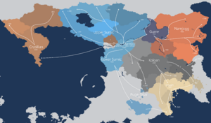
Early Iridian Migration
Classical Period (500-1250)
City States
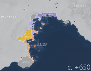
Satevid Empire
Postclassical Period (1250-1700)
Division and 4 Shahdoms
Zahirid Caliphate and Spread of Eubud
Early Modern Period (1700-2000)
The Sublime State - Ashrazid Dynasty
Kingdom of Carsodonia
Late Modern Period (2100<)
Unrest of 2120-2122
The death of the Carsodonian monarch Tiberius in 2120 was seized upon as a moment of opportunity by pro democracy demonstrators across the southern country. They held long standing discontent with Carsodonian minority rule and growing wealth disparity as a result of decaying anti-corruption measures which allowed the funneling of money to the elites. The lack of an immediate heir apparent and growing pressure from the movement forced the formation of a provisional government, promising free and fair elections and the creation of a senate.
However, the provisional government was largely comprised of members of the royal cabinet and continued to delay the elections, and when they were eventually held in 2121, voter suppression efforts organized in the meantime resulted in little meaningful regime change. Appointed expecting to be another regime loyalist, the politician Reza Alkandari from a prominent Carsodon tribe discretely leaked a dossier documenting the details of the government's plans to delay elections until an heir could be appointed.
Whether or not it was legitimate did not matter to the public, and the result was an escalation of violent clashes between protesters and government forces, including the aging Koloan guard, with several ensuing massacres. The Iroan Revolutionary Council was formed in the early days of 2122 in Irostan and declared independence, followed by most of the southern velayats. The council consisted of defecting regional governors and prominent local politicians, and was headed by the governor of Irostan; Khoshar Soradegh, urging a general uprising in a public broadcast closing with the statement:
| “ | "We must recognize that the time of kings and the rule of few now breathes its last breaths. That which has overseen this land for hundreds of years has demonstrated itself to be woefully incompatible with the modern age. It falls upon us then to adapt accordingly: to undertake something that has not yet been attempted on this scale in Iridia's history. I ask all that hear this, regardless of creed and ethnicity, to join us in realizing this new future. Its success depends upon each and every one of you." | ” |
| —Khoshar Soradegh, 2122 | ||
Purple Revolution of 2122
The Velayats of Basrah and Kermanshah soon followed Irostan's example, declaring the Iroan Republic and opening up multiple fronts against the provisional government.
Iroan planning opted for a quick drive towards the capital of Maslouf, hoping that they could link up with protestors there who would join their ranks. However, Carsodonian forces and allied militias had by this point quelled demonstrations and organised a defense, and as such the opening offensive was quickly blunted, becoming bogged down and turning into a stalemate along the small strip of coastline between Belor and the Kirtesh.
This prompted rebel forces, lead by lieutenant general Alariş Kerali to recognize their error, and open up a second front towards the north with the aim of expanding the area of operations which the Carsodonian forces would have to commit troops to. In late 2123, Iroan forces had reached the oasis town of Adish and dug in for a siege whilst attempting to bypass the Kirtesh range, which Carsodonia had turned into a fortress.
Though momentum had been halted in the north, these operations allowed for the swift consolidation of Iroa proper, with the capture of the Avraz and Forghreh military bases housing fightercraft and armoured vehicles. Desperate pleas for international support were answered in 2124, as Wurst warlords took advantage of the chaos in Khwarazm to loot and pillage several townships, killing hundreds and wounding thousands. The resulting Wurst War saw allied forces commit atrocities of their own, devastating what little infrastructure existed, with up to 80% of buildings destroyed by coalition aircraft and the area almost entirely depopulated.
As Iroa lacked experienced high ranking military officers, punishment for those responsible for war crimes in the Iroan military was not immediate as they were deemed still useful for the war effort. Towards this end and that of preserving the revolution's image, they were publically demoted to mid-level positions and were required to stay within kilometers of the front lines where fighting was heaviest, resulting in the deaths of 3 of the 4 convicted perpetrators.
Culture
Literature
Music
Art
A common motif in Iroan art is repeating, branched geometrical patterns. These are typically depicted on carpets and tapestries or as borders on paintings.
Cuisine
Harn meat marinated in spices and served over rice is a popular dish in Iroa
About the Flag
The Iroan flag code describes it as follows: The flag is displayed with a 15:26 aspect ratio. It consists of a grey-black and orange bicolor with the grey-black on top and orange on the bottom. The hoist side features a white chevron containing the national symbol.
Iroa's flag consists of colours historically common and used to represent the region. The grey-black colour reflects Iroa's darkly coloured mountain ranges, while the orange represents the sands of the Kolus desert. The orientation of these two is a simplified approximation of the Iroan landscape. The white chevron is said to represent peace, snow caps or purity.
The national symbol is in part borrowed from the flag of the city state of Wuste, consisting of two yellow arcs forming a circle, representing the two moons of Kerbin, Mun and Minmus. The space in the middle is filled with purple, a colour that has long been associated with the Granas people, and has come to be associated with the ideals of democracy and individual freedom, with entirely purple flags often flown alongside the Iroan flag during the War of Independence. This association is thought to originate with the Crocus Society and its enlightenment thought.
Colour Scheme
| Format | Grey-Black | White | Purple | Orange | Yellow | Dark Yellow |
|---|---|---|---|---|---|---|
| RGB | [64,64,64] | [255,255,255] | [145,126,207] | [237,125,49] | [255,216,0] | [255,191,0] |
| HEX | #404040 | #FFFFFF | #917ECF | #ED7D31 | #FFD800 | #FFBF00 |
