File:GRS Geo Map.png
Jump to navigation
Jump to search
Size of this preview: 553 × 599 pixels. Other resolution: 961 × 1,041 pixels.
Original file (961 × 1,041 pixels, file size: 81 KB, MIME type: image/png)
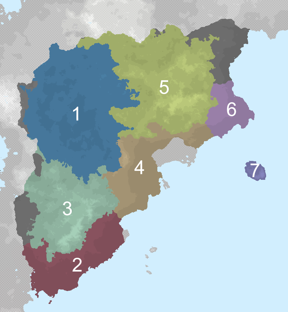
Geographic regions of Grestin
- North Basin
- Svarskia
- The K2 Highlands
- Bal
- Vaisan Highlands
- Eastern Cape
- Diosca
File history
Click on a date/time to view the file as it appeared at that time.
| Date/Time | Thumbnail | Dimensions | User | Comment | |
|---|---|---|---|---|---|
| current | 21:12, 5 September 2025 | | 961 × 1,041 (81 KB) | Spartwo (talk | contribs) | |
| 17:37, 5 September 2025 |  | 961 × 1,041 (90 KB) | Spartwo (talk | contribs) |
You cannot overwrite this file.
File usage
The following page uses this file: