Iroa: Difference between revisions
Jump to navigation
Jump to search
Phoenia652 (talk | contribs) No edit summary |
Phoenia652 (talk | contribs) No edit summary |
||
| Line 17: | Line 17: | ||
|ethnicity = Granas - 48.8% </br> Basra - 29% </br> Iro Wuster - 5.1% </br> Vagani - 5% </br> Basargu - 4.5% </br> Carsodon - 3.8% </br> Tekkian - 3.4% </br> Parast - 0.6% </br> Wuster - 0.1% |
|ethnicity = Granas - 48.8% </br> Basra - 29% </br> Iro Wuster - 5.1% </br> Vagani - 5% </br> Basargu - 4.5% </br> Carsodon - 3.8% </br> Tekkian - 3.4% </br> Parast - 0.6% </br> Wuster - 0.1% |
||
|population = 5,264,395 |
|population = 5,264,395 |
||
| − | |area = 36,527 |
+ | |area = 36,527 |
|flagdesc=The flag of Iroa, featuring its national symbol. |
|flagdesc=The flag of Iroa, featuring its national symbol. |
||
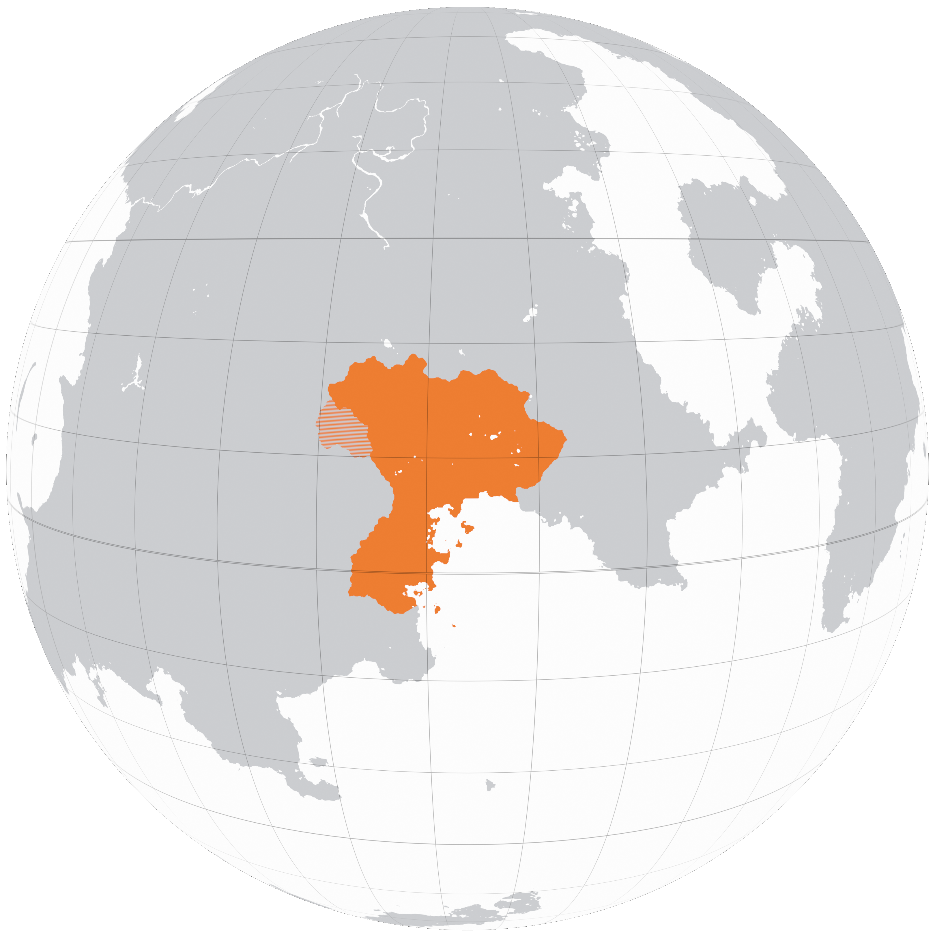
|mapdesc=A map of Iroa in Kolus, 2200 |
|mapdesc=A map of Iroa in Kolus, 2200 |
||
Revision as of 00:22, 28 November 2024
|
Iroan Republic
Jamehori Ayroa
|
|||||
|---|---|---|---|---|---|
 |
|||||
| The flag of Iroa, featuring its national symbol. | |||||
| Motto | "Bah jelo ba npam: Dar azadi" "Forward together; Free" |
||||
| Common Name | Iroa | ||||
| Anthem | "Vatanam" | ||||
 |
|||||
| A map of Iroa in Kolus, 2200 | |||||
| Demonym | Iroan | ||||
| Official languages | Granas, Basra | ||||
| Currency | Rút | ||||
| Politics | |||||
| Capital | Maslouf | ||||
| Government | Devolved unitary parliamentary republic | ||||
| Foundation | 2122 (Declaration of Independence) 2127 (Formal Recognition) |
||||
| First Minister | ? | ||||
| Preceded by | Granderia, Arcovdonia, Phoenia | ||||
| Demography | |||||
| Ethnicities | Granas - 48.8% Basra - 29% Iro Wuster - 5.1% Vagani - 5% Basargu - 4.5% Carsodon - 3.8% Tekkian - 3.4% Parast - 0.6% Wuster - 0.1% |
||||
| Population | 5,264,395 | ||||
| Area | 36,527 km² | ||||
