Grestin: Difference between revisions
mNo edit summary |
m (→Military) |
||
| (5 intermediate revisions by 2 users not shown) | |||
| Line 1: | Line 1: | ||
| − | https://kerbal-powers.fandom.com/wiki/North_Grestin |
||
| − | |||
{{Nation |
{{Nation |
||
| − | |nation = Grestin |
+ | | nation = Grestin |
| − | |localized_name = Grestin |
+ | | localized_name = Grestin |
| − | |full_name = The State of Newest Grestin |
+ | | full_name = The State of Newest Grestin |
| − | |flag = GRS_Flag.png |
+ | | flag = GRS_Flag.png |
| − | |motto = "Fiat Nova Pace Novas Grestin" |
+ | | motto = "Fiat Nova Pace Novas Grestin" |
| − | |anthem = "O'er azure skies" |
+ | | anthem = "O'er azure skies" |
| − | |map = GRS_Globe.png |
+ | | map = GRS_Globe.png |
| − | |denonym = Grestian |
+ | | denonym = Grestian |
| − | |capital = Ambargo |
+ | | capital = Ambargo |
| − | |languages = Kostel, Strelkan(Regional) |
+ | | languages = Kostel, Strelkan(Regional) |
| − | |government = Confederal Presidential Republic |
+ | | government = Confederal Presidential Republic |
| − | |foundation = 2145 (Current Constitution) |
+ | | foundation = 2145 (Current Constitution) |
| − | |leader = David Kerman |
+ | | leader = David Kerman |
| − | |ethnicity = 75.1% Grestian<br />11.6% Strelkan<br />3.3% Other |
+ | | ethnicity = 75.1% Grestian<br />11.6% Strelkan<br />3.3% Other |
| − | |population = |
+ | | population = 9,548,325 |
| − | |area = |
+ | | area = 48,919 |
| − | |flagdesc= |
+ | | flagdesc = |
| − | |mapdesc= |
+ | | mapdesc = |
| + | | predecessor = [[Strelka-Grestinia]], [[Diosca]], [[Grestin-Celrapan]] |
||
| − | |predecessor= |
||
| − | |successor |
+ | | successor = |
| + | | currency = Grestian Fund |
||
| + | }} |
||
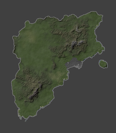
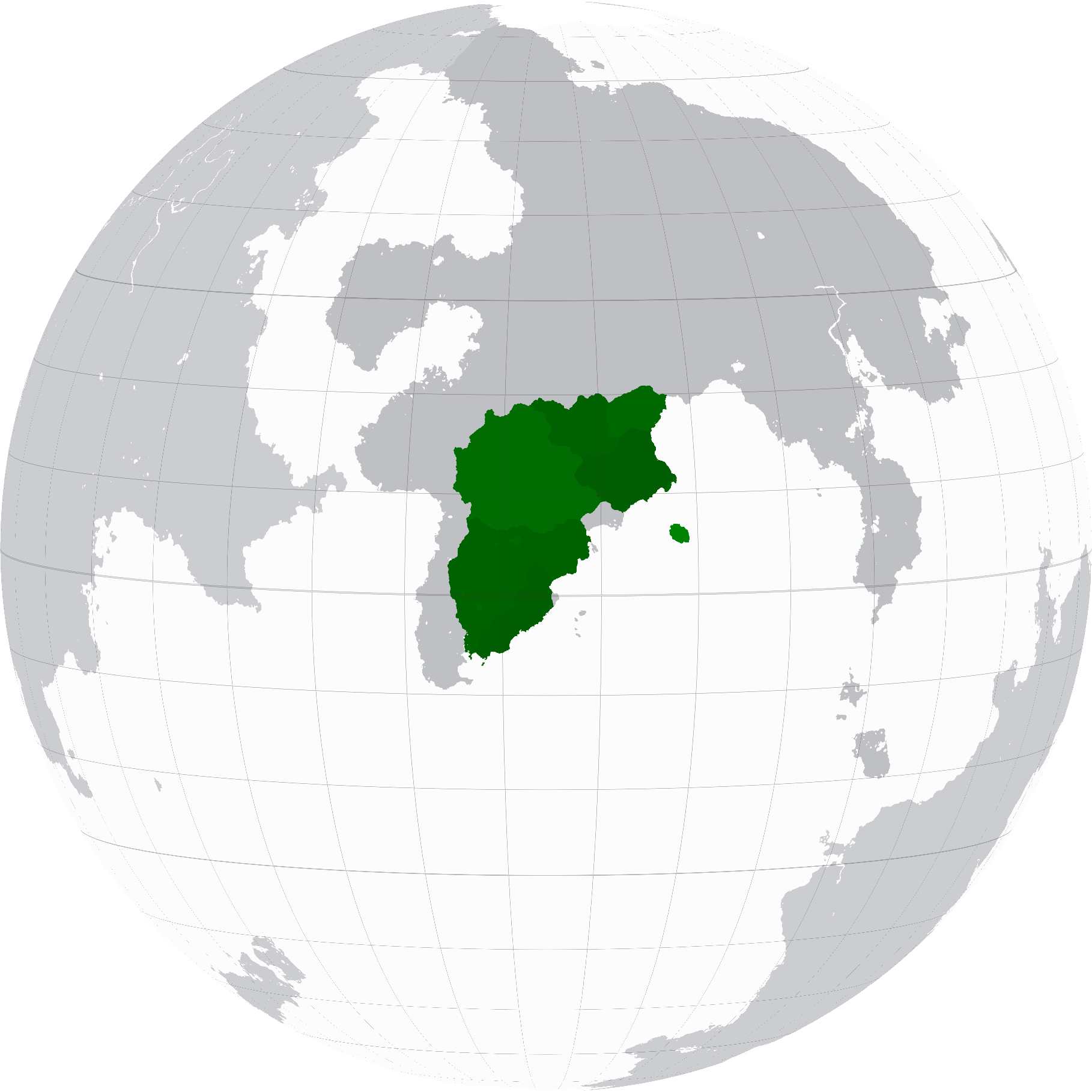
| + | '''Grestin''' (Kostel: [ɡɹɛstɪn]), also known as '''Newest Grestin''', is a country located in south [[Kafrica]]. The country is externally bordered by [[Aontas]] to the west, [[Solaria]] and [[Krome]] to the north, and the city states of the [[KSC]] and [[Chikushinal]] to the east. It follows a largely straight . It covers an area of 48,919km² and has a population of roughly 9.5 million. The capital of Grestin is [[Ambargo]], which is the nations 3rd largest population centre behind [[Diosca(City)|Diosca]] and [[Portsjeb]]. |
||
| − | https://kerbal-powers.fandom.com/wiki/Grestin |
||
| + | |||
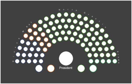
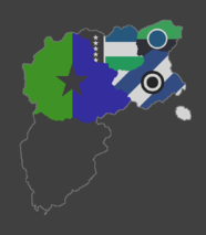
| + | Due to its many historial partions, Grestin is a mixed patchwork of confederal states comprising 3 distinct and highly autonomous entities and a large number of smaller administered regions. |
||
| + | |||
| + | The country as it exists today was established following the 2152 [[Kafrican Accords]], which marked an official end to the [[Three-Grestins Period]]. In exchange for concessions on territorial claims, the previously referred to ''"Ambargo Government"'', would act as the seat of a unified government. Modern Grestin officially claims to be a direct successor to the Grestin national governments of 1922-1974 and 1999-2084. |
||
| + | {{OOC Note|Grestin is normally played by ZooNamed but in the modern 2100s this was Spartwo instead}} |
||
| + | The governments and citizenry of historical Grestin would hold a worldwide reputation of being paradoxically conflict averse and unwilling to concede, a trait that many historians point towards as a driving factor for the successes of the partially celrapani ambargo government in forcefully unifying the nation. |
||
| − | https://kerbal-powers.fandom.com/wiki/Grestine |
||
== Etymology == |
== Etymology == |
||
| Line 33: | Line 38: | ||
The State of Newest Grestin is a nation located in south-west Kafrica, with former krome bordering to the north-east, Strelka South Kafrica to the south, Ophir to the North-west, and Phoenia to the West. |
The State of Newest Grestin is a nation located in south-west Kafrica, with former krome bordering to the north-east, Strelka South Kafrica to the south, Ophir to the North-west, and Phoenia to the West. |
||
| − | It lies mostly between latitudes 7° and 21°N |
+ | It lies mostly between latitudes -7° and 21°N. |
| + | {| class="wikitable" |
||
| + | |+ |
||
| + | ! colspan="2" |Territory Size by Region |
||
| + | |- |
||
| + | |Diosca Island |
||
| + | |389 |
||
| + | |- |
||
| + | |Republic of Diosca |
||
| + | |6,549 |
||
| + | |- |
||
| + | |Kroman Enclave |
||
| + | |2,981 |
||
| + | |- |
||
| + | |Svarskia |
||
| + | |4,140 |
||
| + | |- |
||
| + | |Suid-Kafrica |
||
| + | |12,877 |
||
| + | |- |
||
| + | |Strelkan Enclaves |
||
| + | |213 |
||
| + | |- |
||
| + | |Celrapani Frontier |
||
| + | |4,620 |
||
| + | |- |
||
| + | |Grestin Proper |
||
| + | |17,149 |
||
| + | |- |
||
| + | |'''Total''' |
||
| + | |48,919 |
||
| + | |} |
||
| + | Grestian territory covers 48,919km² which when broken up by region |
||
| + | |||
| + | a farther 13,565km² 7,080km² 23,696km² in Grestin Proper. |
||
Elevation ranges from the Vaisan Mountains (highest point: mt Zambil at 5,614m) in the west to the shores of the Kroman Enclave on the coast. |
Elevation ranges from the Vaisan Mountains (highest point: mt Zambil at 5,614m) in the west to the shores of the Kroman Enclave on the coast. |
||
| Line 60: | Line 99: | ||
=== Languages === |
=== Languages === |
||
| + | Although having no official state language, the primary spoken language within Grestin is [[Kostel]] which is spoken by 68.5% of the population who are focused in ''"Grestin Proper"'' and Diosca. Following that 17.9% speak Settler Strelkan, a number seeing ongoing decline since the official establishment of [[Chikushinal]] following the [[Kafrican Accords]]. |
||
| + | |||
| + | Smaller but still notable portions of the population also speak languages such as [[KSCrian]], [[Celrapani]], and [[Aontan]] due to bordering regions. Localised city sized areas are also noted for speaking high proportions of the languages brought in during periods acting as [[Treaty Port|treaty ports]] such as [[Zokesian]] Dialects, [[Arkadii]], or [[Solten]]. |
||
| − | <nowiki>###</nowiki> |
||
===Education=== |
===Education=== |
||
<nowiki>###</nowiki> |
<nowiki>###</nowiki> |
||
| Line 72: | Line 113: | ||
==Military== |
==Military== |
||
| − | <gallery mode="slideshow"> |
||
| − | Image:GRS_Air.png|''Source'' [[Cabrian Aeroworks]]/[[Proole]] |
||
| − | Image:GRS_Navy.png|''Source'' [[Kering]] |
||
| − | Image:GRS_Military.png|''Source'' [[Corais Sfear]] |
||
| − | Image:GRS_Space.png| ''Source'' [[Sigma Technical]] |
||
| − | </gallery> |
||
=== Air Corp === |
=== Air Corp === |
||
| + | [[File:GrestianBelugaleo04-05-2158.png|thumb|300px|The [[New Grestin Air Force|New Grestin Air Force's]] [[EL-512 Belugaléo]] is escorted by [[D-3 Triangulum]] drones during a routine flight.]] {{Main|[[New Grestin Air Force]]}} |
||
| − | <nowiki>###</nowiki> |
||
===Army=== |
===Army=== |
||
<nowiki>###</nowiki> |
<nowiki>###</nowiki> |
||
| Line 87: | Line 122: | ||
===Orbcom=== |
===Orbcom=== |
||
<nowiki>###</nowiki><br /> |
<nowiki>###</nowiki><br /> |
||
| + | |||
==Economy== |
==Economy== |
||
| Line 195: | Line 231: | ||
| − | Annexed in 2098, Succeeded by Grestine |
||
| − | |||
| − | Name |
||
| − | ### |
||
| − | |||
| − | Geography |
||
| − | The North Grestin Confederacy is a medium nation in the south of Kafrica. It shares borders with Tekkia, Krome, New Grestin, and Celrapani Unorganised Territories to the north. North Grestin has a short coastline along the KS Sea. The territories of North Grestin cover [X] square kilometers, making it the [X] largest nation on the continent behind [X] |
||
| − | |||
| − | North Grestin is surrounded on most sides by highlands or mountainous areas. Despite this the interior of the nation is mostly plainar. |
||
| − | |||
| − | Climate |
||
| − | ### |
||
| − | |||
| − | Biodiversity |
||
| − | ### |
||
| − | |||
| − | Urban Areas |
||
| − | ### |
||
| − | |||
| − | Politics |
||
| − | Government |
||
| − | ### |
||
| − | |||
| − | Subdivisions |
||
| − | ### |
||
| − | |||
| − | Foreign Relations |
||
| − | ### |
||
| − | |||
| − | Demographics |
||
| − | Languages |
||
| − | ### |
||
| − | |||
| − | Education |
||
| − | ### |
||
| − | |||
| − | Religion |
||
| − | ### |
||
| − | |||
| − | Age |
||
| − | ### |
||
| − | |||
| − | Military |
||
| − | Air Corp |
||
| − | ### |
||
| − | |||
| − | Army |
||
| − | ### |
||
| − | |||
| − | Navy |
||
| − | ### |
||
| − | |||
| − | Orbcom |
||
| − | ### |
||
| − | |||
| − | Economy |
||
| − | Taxation |
||
| − | ### |
||
| − | |||
| − | Transport |
||
| − | ### |
||
| − | |||
| − | Energy and Infrastructure |
||
| − | ### |
||
| − | |||
| − | Trade |
||
| − | ### |
||
History |
History |
||
Latest revision as of 22:40, 22 May 2024
|
The State of Newest Grestin
Grestin
|
|||||
|---|---|---|---|---|---|
 |
|||||
| Motto | "Fiat Nova Pace Novas Grestin" | ||||
| Common Name | Grestin | ||||
| Anthem | "O'er azure skies" | ||||
 |
|||||
| Demonym | Grestian | ||||
| Official languages | Kostel, Strelkan(Regional) | ||||
| Currency | Grestian Fund | ||||
| Politics | |||||
| Capital | Ambargo | ||||
| Government | Confederal Presidential Republic | ||||
| Foundation | 2145 (Current Constitution) | ||||
| Preceded by | Strelka-Grestinia, Diosca, Grestin-Celrapan | ||||
| Demography | |||||
| Ethnicities | 75.1% Grestian 11.6% Strelkan 3.3% Other |
||||
| Population | 9,548,325 | ||||
| Area | 48,919 km² | ||||
Grestin (Kostel: [ɡɹɛstɪn]), also known as Newest Grestin, is a country located in south Kafrica. The country is externally bordered by Aontas to the west, Solaria and Krome to the north, and the city states of the KSC and Chikushinal to the east. It follows a largely straight . It covers an area of 48,919km² and has a population of roughly 9.5 million. The capital of Grestin is Ambargo, which is the nations 3rd largest population centre behind Diosca and Portsjeb.
Due to its many historial partions, Grestin is a mixed patchwork of confederal states comprising 3 distinct and highly autonomous entities and a large number of smaller administered regions.
The country as it exists today was established following the 2152 Kafrican Accords, which marked an official end to the Three-Grestins Period. In exchange for concessions on territorial claims, the previously referred to "Ambargo Government", would act as the seat of a unified government. Modern Grestin officially claims to be a direct successor to the Grestin national governments of 1922-1974 and 1999-2084.
The governments and citizenry of historical Grestin would hold a worldwide reputation of being paradoxically conflict averse and unwilling to concede, a trait that many historians point towards as a driving factor for the successes of the partially celrapani ambargo government in forcefully unifying the nation.
Etymology
###
Geography
The State of Newest Grestin is a nation located in south-west Kafrica, with former krome bordering to the north-east, Strelka South Kafrica to the south, Ophir to the North-west, and Phoenia to the West.
It lies mostly between latitudes -7° and 21°N.
| Territory Size by Region | |
|---|---|
| Diosca Island | 389 |
| Republic of Diosca | 6,549 |
| Kroman Enclave | 2,981 |
| Svarskia | 4,140 |
| Suid-Kafrica | 12,877 |
| Strelkan Enclaves | 213 |
| Celrapani Frontier | 4,620 |
| Grestin Proper | 17,149 |
| Total | 48,919 |
Grestian territory covers 48,919km² which when broken up by region
a farther 13,565km² 7,080km² 23,696km² in Grestin Proper.
Elevation ranges from the Vaisan Mountains (highest point: mt Zambil at 5,614m) in the west to the shores of the Kroman Enclave on the coast.
Climate
###
Biodiversity
###
Urban Areas
###
Politics
Government
###
Substates
Foreign Relations
###
Demographics
Languages
Although having no official state language, the primary spoken language within Grestin is Kostel which is spoken by 68.5% of the population who are focused in "Grestin Proper" and Diosca. Following that 17.9% speak Settler Strelkan, a number seeing ongoing decline since the official establishment of Chikushinal following the Kafrican Accords.
Smaller but still notable portions of the population also speak languages such as KSCrian, Celrapani, and Aontan due to bordering regions. Localised city sized areas are also noted for speaking high proportions of the languages brought in during periods acting as treaty ports such as Zokesian Dialects, Arkadii, or Solten.
Education
###
Religion
###
Age
###
Military
Air Corp
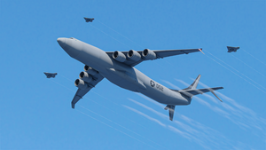
- Main Article: New Grestin Air Force
Army
###
###
Orbcom
###
Economy
Taxation
###
Transport
###
Energy and Infrastructure
###
Trade
###
Science
###
History
Notable Events
About The Flag
Geography
The Unified State of Grestin is a small nation in the south of Kafrica. It shares borders with Tekkia, the KSC, and Strelka to the north. North Grestin has a moderate coastline along the KS Sea. The territories of North Grestin cover 12 thousand square kilometers, making it the 7th largest nation on the continent behind Azenia
Grestin is largely comprised of mountainous terrain with most plainar areas lying near to the coast.
Politics Government Grestin's current government is a democracy with all people involved in government affairs and actions. Using modern technology for current and near instantaneous decisions and ratification. A system of governance akin to the Jool centric Solari model.
Every 10 years a 'Grand Citizen' is elected to act as a figure head of the nation and to act as the impartial judge of national affairs needing an unbiased voice, as well as act as an overriding force on divisive votes.
List of Grand Citizens:
Hal Kerman (2101-2111*)
- Expected term end.
Provinces Grestin is comprised of 6 territories, 3 of which are coastal. The northmost of these, the nation's namesake houses the capitol.
Foreign Relations However making political alliances with select groups after heavy negotiations and decisions being made by the people. Protecting any vassal or fellow MDP allies of Grestin.
Military The Grestin is a militarily neutral state. Not fighting unless attacked.
Population The people of New Grestin live in two main areas along the South Kafrican Banana. Port Jebidiah straddles the border with the Kerbal Space Center housing a population of 1.5 million. To the south of the capitol lie Pogo and South Post each with a population of 0.5 million Kerbals.
Economy Education The city of south post houses Grestin's three main education centres Bob Kerman Memorial College; Jebediah Memorial Flight University; and Bill's Aeronautical University for Military Cadets. Which receive an average thirty thousand applications a year.
Science and Technology The Unified State is known for such major developments as the NS-5 robots unveiled in the 2050s, the first colonization of Laythe in the same decade, the deployment of the Super GRUNT spacecraft , the creation of Peter the artificial Kerbal, among other developments.
Old Government The New Grestin States was run by new system of government that allowed for a single ruler that was checked by 2 divisions, one which managing the Kerbal's rights and votes (Domestic Branch) and another branch which manages the Bill of Actions (Administrative Branch).
File:NG states.png The Bill of Action listed what a leader may and may not do... but aside from that the leader or- Commander in Chief must take action as to progress the nation in the best way forward as they are selected by a cabinet every 10 years... however a leader may be removed from office should they break the regulations of the Bill of Actions. The New Grestin States takes a stand point of having no single political "party" but rather be a single entity which works towards set goals made by the Domestic as requested by the people.
Final Government Leaders:
Commander in Chief: MacArthur Kerman Domestic Head of Office: Spaghetti Kerman Head of Administrative Branch: Denver Kerman New Grestin General of Arms: Dewey Kerman Office of Foreign Affairs: Unni Kerman Past New Grestin Commander in Chiefs:
Kennedy Kerman (2038-2050) Kellen Kerman (2051-2057) Kessler Kerman (2058-2063) Burger Kerman (2063-2069) Peter (2070-2078) MacArthur Kerman (2078-2086)*
- expected complete term
Past New Grestin General At Arms:
Jabe Kerman (2041-2052) Dewey Kerman (2052-) Past New Grestin Head of Foreign Affairs Office
Bonnie Kerman (2040-2066) Unni Kerman (2070-) Past New Grestin Head of Domestic Affairs Office
Amy Kerman (2040-2077) Spaghetti Kerman (2077-) Past New Grestin Head of Administrative Office
Chaffee Kerman (2039-2077) Edward White Kerman (2077-) Military COMING SOON
History Pre-2041 NGS was reborn from the fall of the old governments. Angus Kerman is regarded as the father of the nation who decided to remake the government and reboot the mainland's power. So he created the current constitution alongside Shawn Kerman, Gus Kerman and Felix Kerman. Angus was elected to be the Commander in Chief thereafter, serving for four successive terms. Efforts in science took place throughout the Kerbin the largest housed in the mountains of New Grestin. On top of K2 the largest observatory on Kerbin can be found. Science teams have also been sent to the North and South poles for further exploration and research.
History Heart of Grestin North Grestin is considered the heart of tradition in the nation.
Annexation Georgia In the years following annexation North Grestin spent some years as the Zokesian client state of Georgia
Federal Association Through the Great Decline North Grestin remained part of the federation throughout the early years of the decline, only falling into disorganization
Restored New Grestin States Anti-Capitol Sentiments The unpredictable nature of the NGS’s actions led many fundamentalists to grow dissatisfied with the decisions being made by Jebidiah Spaceport. A final blow was dealt to Grestin unity in the aftermath of the Great Kerbin War as the nation was invaded and occupied. Watching as New Grestin simultaneously refused to end the conflict or fight for a victory.
The North Grestin Confederacy secceeded in early 2084 following the collapse of the New Grestin government.
Independence A Failed State Kafraic Theas Invasion and Partition Notable Events Secession - 2084
Annexation - 2098
About The Flag Categories
