Rhudbeal: Difference between revisions
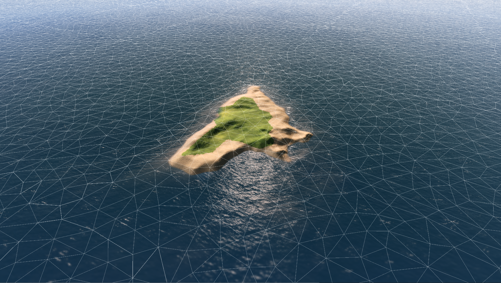
(Created page with "{{Location |name = Rhudbeal |localized_name = Rúidbheal |type = Autonomous Region |image = Rhudbeal_Overview.png |caption = Reconstructed Image of Rhudbeal Topography generated from successive overflights |location = Gulf of Iro, Caledon (Continent) | sma = | inclination = |coordinates = -21° 0' 0" N, -124° 0' 0" E {{Location/History |founded = Vemáey 4th, 1489|found_word = Formally Settled |unfounded = |unfound_word = }} {{Location/City |flag...") |
mNo edit summary |
||
| (7 intermediate revisions by the same user not shown) | |||
| Line 10: | Line 10: | ||
|coordinates = -21° 0' 0" N, -124° 0' 0" E |
|coordinates = -21° 0' 0" N, -124° 0' 0" E |
||
{{Location/History |
{{Location/History |
||
| − | |founded = Vemáey 4th, |
+ | |founded = Vemáey 4th, 1689|found_word = Formally Settled |
|unfounded = |unfound_word = |
|unfounded = |unfound_word = |
||
}} |
}} |
||
| Line 17: | Line 17: | ||
|population = 16,809 (2200 Estimate) |
|population = 16,809 (2200 Estimate) |
||
|denonyms = Rhud<br/>Rhudbeal(Possesive) |
|denonyms = Rhud<br/>Rhudbeal(Possesive) |
||
| − | |elevation = |
+ | |elevation = (Highest Point) 271 |
}} |
}} |
||
{{Location/Garrison |
{{Location/Garrison |
||
| − | |commander = |
+ | |commander = Lorcan Reed-Kerman |
| − | |garrison = |
+ | |garrison = 15,000-20,000 |
| − | |occupants = |
+ | |occupants = 1st Expeditionary |
}} |
}} |
||
{{Location/Port |
{{Location/Port |
||
| Line 30: | Line 30: | ||
{{Location/Airfield |
{{Location/Airfield |
||
|directions = 210L/60R |
|directions = 210L/60R |
||
| − | |lengths = 1 |
+ | |lengths = 1,125m |
|surfaces = Concrete |
|surfaces = Concrete |
||
}} |
}} |
||
}} |
}} |
||
| + | {{Distinguish|[[Rhudbeal|Rhudbeal(Island)]]}} |
||
| − | '''Rhudbeal''' is an autonomous island district of [[Tekkia]]. |
||
| + | |||
| + | '''Rhudbeal''' ([[Aontan_Language|Aontan]] '''Rúidbheal''' [rudbeɪl]) is an autonomous district of [[Tekkia]] in the [[Gulf of Iro]] Subregion of the [[Great Kerbin Sea]]. |
||
| + | |||
| + | Rhudbeal's primary town is Pontodas, which serves as the islands administrative capital. It lies at a geographic, distance-based extremity of Tekkia and Aontas. Rhudbeal is one of the 7 main islands of the Caledonian island chain. |
||
| + | |||
| + | Though maintaining limited political autonomy, persons born on Rhudbeal are enfranchised within the greater Federal Electoral system. As of 2200, Rhudbeal's civillian population is 16,809. The territory spans 114 square kilometres and has a population density of 148 per square kilometre. |
||
| + | |||
| + | Indigenous people first settled the island approximately [year estimate]. Rhudbeal was colonised by Tekkia in 1689. Between the 16th and 20th centuries it served as an important stopover for naval vessels moving between the Tekkian mainland and its various [[Former Tekkian Colonies|Colonial Holdings]]. During the [[Great Decline]], the island operated in a state of defacto independence. Since the advent of flight, Rhudbeal's economy has been supported primarily by the military, for which the island is a major strategic asset. |
||
| + | |||
| + | ==History== |
||
| + | |||
| + | ===Pre-Colonisation=== |
||
| + | |||
| + | ===Colonial Period=== |
||
| + | |||
| + | ===Early Industrial Kerbin=== |
||
| + | |||
| + | ===The Great Decline=== |
||
| + | |||
| + | ===Formative Era - Era of Strife=== |
||
| + | |||
| + | ===Consolidation Era=== |
||
| + | |||
| + | ===Frontier Era=== |
||
| + | |||
| + | |||
| + | |||
| + | |||
| + | ==Geography and Environment== |
||
| + | {{Main|[[Geography of Caledon]]}} |
||
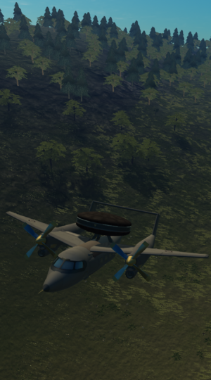
| + | [[File:ScanoirRhudbeal.png|thumb|A Scanoir-N naval patrol aircraft flying low over Rhudbeal's highest terrain.]] |
||
| + | Rhudbeal is [x] kilometres long and [x] kilometres wide. It has an area of 114 square kilometres. It is the largest island within the territory of [[Tekkia]] and the second largest within [[Aontas|Greater Aontas]] behind [[Diosca(Island)|Diosca]]. It is the northernmost and island in the Caledonian Island Chain. Rhudbeal is the geographically southernmost point of Tekkia and [[Aontas]], and the westernmost point of the forme as measured from the geographic center of both. |
||
| + | |||
| + | The chain of which Rhudbeal is a part, was created by collision of the Kolusian and Southern [[Tectonic Plates|tectonic plates]]. Volcanic eruptions established the base of the island 26 to 30 million years ago. Rhudbeal's highest point is lies at 271 metres above sea level. The Tekkian [[Federal Armed Forces(Tekkia)|Federal Armed Forces]] own roughly 40% of the island. |
||
| + | |||
| + | ===Climate=== |
||
| + | Rhudbeal has different bioclimates based on prevalant winds, humidity, and sun exposure. The island is strongly influenced by the gulf stream. Based on the Köppen scale; western Rhudbeal has a [] climate, southern a []. and north-eastern a []. The weather is generally [] with little seasonal temperature variation. Rhudbeal is known to have equable temperatures year-round. Trade winds are fairly constant throughout the year running in a [] direction |
||
| + | |||
| + | The wettest month on record at Rhud Naval Airbase has been [month year] with 699.6 mm. The driest was [month year] with 2.4 mm. The mean high temperature is [x]°C. The relative humidity commonly reaches [x]% at night throughout the year. The highest temperature ever recorded on Rhudbeal was [x]°C on [day year] with the lowest being [x]°C recorded on [day year]. |
||
| + | |||
| + | ==Demographics== |
||
| + | Unlike most of its neighbors, the island was settled by Tekkia, especially those from the eastern half, meaning that inhabitants are primarily ethnically Aontan, though they have developed their own distinct regional identity and cultural traits. In the 2196 Aontan Census, the largest ethnic group was Soir Tekkian, accounting for 57.2% of the population. The remaing 42.8% is comprised of Sair Tekkians, Iroans, Caledon, Bastian, and Solten individuals. |
||
| + | |||
| + | The island has a total population of just under 16,000, the majority of whom live on the northern coast..The predominant religion of Rhudbeal is [x]. |
||
| + | {| class="wikitable" |
||
| + | |+Historical population |
||
| + | !Census |
||
| + | !<abbr>Pop.</abbr> |
||
| + | !Note |
||
| + | !<abbr>%±</abbr> |
||
| + | |- |
||
| + | !1900 |
||
| + | | |
||
| + | | |
||
| + | |— |
||
| + | |- |
||
| + | !1925 |
||
| + | | |
||
| + | | |
||
| + | | |
||
| + | |- |
||
| + | !1950 |
||
| + | | |
||
| + | | |
||
| + | | |
||
| + | |- |
||
| + | !1975 |
||
| + | | |
||
| + | | |
||
| + | | |
||
| + | |- |
||
| + | !2000 |
||
| + | | |
||
| + | | |
||
| + | | |
||
| + | |- |
||
| + | !2025 |
||
| + | | |
||
| + | | |
||
| + | | |
||
| + | |- |
||
| + | !2050 |
||
| + | | |
||
| + | | |
||
| + | | |
||
| + | |- |
||
| + | !2075 |
||
| + | | |
||
| + | | |
||
| + | | |
||
| + | |- |
||
| + | !2100 |
||
| + | | |
||
| + | | |
||
| + | | |
||
| + | |- |
||
| + | !2125 |
||
| + | | |
||
| + | | |
||
| + | | |
||
| + | |- |
||
| + | !2150 |
||
| + | | |
||
| + | | |
||
| + | | |
||
| + | |- |
||
| + | !2175 |
||
| + | | |
||
| + | | |
||
| + | | |
||
| + | |- |
||
| + | !2200 |
||
| + | | |
||
| + | | |
||
| + | | |
||
| + | |} |
||
| + | |||
| + | ==Culture== |
||
| + | |||
| + | ===Music=== |
||
| + | |||
| + | ===Cuisine=== |
||
| + | |||
| + | ===Beverages=== |
||
| + | |||
| + | ===Sports=== |
||
| + | |||
[[Category:Locations]] |
[[Category:Locations]] |
||
[[Category:Islands]] |
[[Category:Islands]] |
||
Latest revision as of 22:18, 22 October 2024
|
Rhudbeal
Rúidbheal
|
|||||||||||||||||||
|---|---|---|---|---|---|---|---|---|---|---|---|---|---|---|---|---|---|---|---|
| Autonomous Region | |||||||||||||||||||
 |
|||||||||||||||||||
| Reconstructed Image of Rhudbeal Topography generated from successive overflights | |||||||||||||||||||
| Location | Gulf of Iro, Caledon (Continent) | ||||||||||||||||||
| Coordinates | -21° 0' 0" N, -124° 0' 0" E | ||||||||||||||||||
| Formally Settled | |||||||||||||||||||
| Vemáey 4th, 1689 | |||||||||||||||||||
| Urban Area | |||||||||||||||||||
|
|||||||||||||||||||
| Population | 16,809 (2200 Estimate) | ||||||||||||||||||
| Demonyms | Rhud Rhudbeal(Possesive) |
||||||||||||||||||
| Elevation | (Highest Point) 271 m (ASL) | ||||||||||||||||||
| Garrison Information | |||||||||||||||||||
| Current Commander | Lorcan Reed-Kerman | ||||||||||||||||||
| Garrison | 15,000-20,000 | ||||||||||||||||||
| Occupants | 1st Expeditionary | ||||||||||||||||||
| Port Classification | Blue | ||||||||||||||||||
| Size of Harbor | 510ha | ||||||||||||||||||
|
|||||||||||||||||||
Not to be confused with Rhudbeal(Island).
Rhudbeal (Aontan Rúidbheal [rudbeɪl]) is an autonomous district of Tekkia in the Gulf of Iro Subregion of the Great Kerbin Sea.
Rhudbeal's primary town is Pontodas, which serves as the islands administrative capital. It lies at a geographic, distance-based extremity of Tekkia and Aontas. Rhudbeal is one of the 7 main islands of the Caledonian island chain.
Though maintaining limited political autonomy, persons born on Rhudbeal are enfranchised within the greater Federal Electoral system. As of 2200, Rhudbeal's civillian population is 16,809. The territory spans 114 square kilometres and has a population density of 148 per square kilometre.
Indigenous people first settled the island approximately [year estimate]. Rhudbeal was colonised by Tekkia in 1689. Between the 16th and 20th centuries it served as an important stopover for naval vessels moving between the Tekkian mainland and its various Colonial Holdings. During the Great Decline, the island operated in a state of defacto independence. Since the advent of flight, Rhudbeal's economy has been supported primarily by the military, for which the island is a major strategic asset.
History
Pre-Colonisation
Colonial Period
Early Industrial Kerbin
The Great Decline
Formative Era - Era of Strife
Consolidation Era
Frontier Era
Geography and Environment
- Main Article: Geography of Caledon
Rhudbeal is [x] kilometres long and [x] kilometres wide. It has an area of 114 square kilometres. It is the largest island within the territory of Tekkia and the second largest within Greater Aontas behind Diosca. It is the northernmost and island in the Caledonian Island Chain. Rhudbeal is the geographically southernmost point of Tekkia and Aontas, and the westernmost point of the forme as measured from the geographic center of both.
The chain of which Rhudbeal is a part, was created by collision of the Kolusian and Southern tectonic plates. Volcanic eruptions established the base of the island 26 to 30 million years ago. Rhudbeal's highest point is lies at 271 metres above sea level. The Tekkian Federal Armed Forces own roughly 40% of the island.
Climate
Rhudbeal has different bioclimates based on prevalant winds, humidity, and sun exposure. The island is strongly influenced by the gulf stream. Based on the Köppen scale; western Rhudbeal has a [] climate, southern a []. and north-eastern a []. The weather is generally [] with little seasonal temperature variation. Rhudbeal is known to have equable temperatures year-round. Trade winds are fairly constant throughout the year running in a [] direction
The wettest month on record at Rhud Naval Airbase has been [month year] with 699.6 mm. The driest was [month year] with 2.4 mm. The mean high temperature is [x]°C. The relative humidity commonly reaches [x]% at night throughout the year. The highest temperature ever recorded on Rhudbeal was [x]°C on [day year] with the lowest being [x]°C recorded on [day year].
Demographics
Unlike most of its neighbors, the island was settled by Tekkia, especially those from the eastern half, meaning that inhabitants are primarily ethnically Aontan, though they have developed their own distinct regional identity and cultural traits. In the 2196 Aontan Census, the largest ethnic group was Soir Tekkian, accounting for 57.2% of the population. The remaing 42.8% is comprised of Sair Tekkians, Iroans, Caledon, Bastian, and Solten individuals.
The island has a total population of just under 16,000, the majority of whom live on the northern coast..The predominant religion of Rhudbeal is [x].
| Census | Pop. | Note | %± |
|---|---|---|---|
| 1900 | — | ||
| 1925 | |||
| 1950 | |||
| 1975 | |||
| 2000 | |||
| 2025 | |||
| 2050 | |||
| 2075 | |||
| 2100 | |||
| 2125 | |||
| 2150 | |||
| 2175 | |||
| 2200 |


